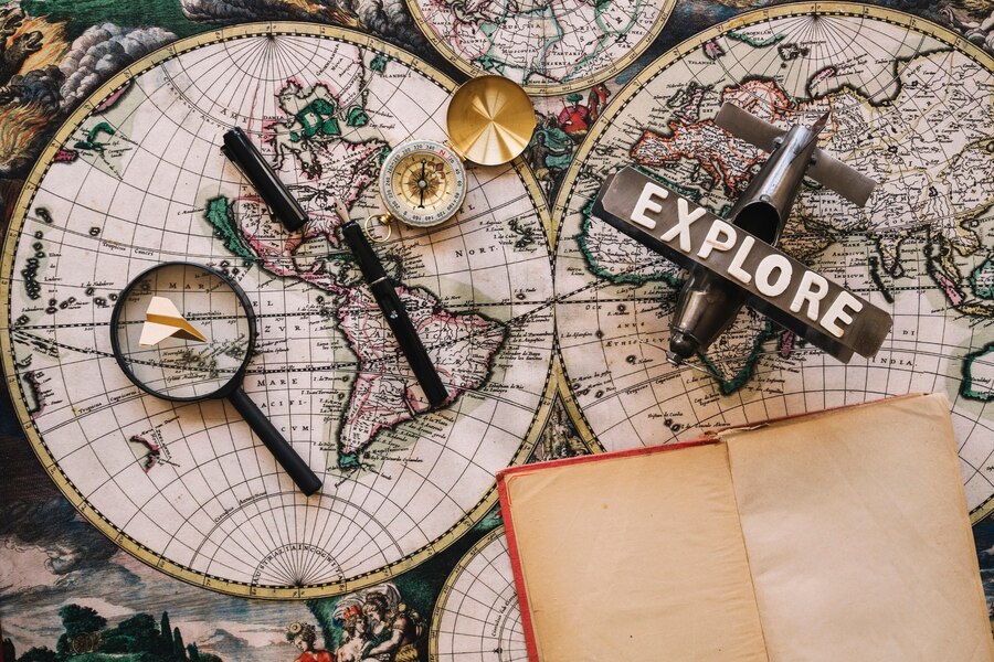
Imagine possessing the power to travel back in time, peering into the past to witness how the world once appeared.
Vintage maps offer that opportunity, allowing you to delve into bygone eras through detailed lines and artistic representations of the world as it existed in earlier times.
These thoughtfully constructed works not only capture the geographical understanding of their era but also reflect the cultural, artistic, and technological factors that influenced society.
Every vintage map narrates a distinctive story, be it a detailed city layout depicted in a USGS map from a year ago or a territorial map unveiling a vastly transformed global landscape.
What Is A “Vintage” Map?
A vintage map was created in the past, often showcasing the core geographical knowledge and artistic techniques of its era. These maps can span from several decades to centuries. They can also entail the then-geographical stature of a country or a state.
A: The History Of Vintage Maps
Ancient civilizations such as Babylon, Egypt, and China kickstarted the early stages of mapmaking, offering primitive depictions of their environments.
As exploration and trade flourished, so did cartography, progressing toward more precise and intricate maps thanks to contributions from diverse cultures.
The “Golden Age of Cartography” occurred in the 16th and 17th centuries as European explorers embarked on global journeys.
During this period, mapmakers such as Gerardus Mercator and Abraham Ortelius crafted exceptionally detailed and influential maps.
These maps served not only as practical aids for navigation but also as artistic masterpieces highlighting the mapmakers’ expertise and imagination.
B: Why Are They So Popular?
It’s quite difficult to answer. Some people love buying vintage map prints online due to their aesthetic presence, while others consider them to be valuable collectibles.
1: The Aesthetic Brilliance
As mentioned before, a vintage map tends to be the epitome of artistic intricacy. For example, they feature various decorative elements, ornate borders, and enticing color palettes.
Their overall aesthetic appeal also adds a curious sense of character and charm to any space. I think they can be a great conversation piece and a core testament to the mapmaker’s skills.
But how can they make your interior look better?
Well, due to their vintage styling and persona — they can imbue a touch of sophistication and elegance to your home’s overall decoration. Depending on what you have bought, these might also increase the house’s historical significance too.
2: Perfect As A Collectible
Collecting vintage map prints is an enriching and satisfying pastime that invites enthusiasts to delve into the intricate blend of history, art, and geography. Each map boasts distinct qualities, granting collectors the chance to delve into diverse eras, societies, and cartographic methods.
For collectors, there’s the excitement of uncovering unique and prized items, all while forging a meaningful link to bygone times. With an array of map variations available for collection, the hobby promises perpetual fascination and variety.
3: A Decorative Or Sentimental Appeal
Antique maps carry emotional significance for numerous individuals, acting as mementos of familial origins, cultural legacy, or treasured journeys.
They frequently adorn personal collections and serve as ornamental pieces in residences, workplaces, or commercial spaces, lending an air of historical allure to their environment.
4: Future Legacy And Investment
Investing in vintage maps isn’t just about enjoying them – it’s also a savvy financial decision. As these treasures become scarcer, their worth rises, which, in turn, makes them desirable investments.
Plus, handing down most of these maps through generations turns them into beloved family keepsakes, holding both historical importance and sentimental worth.
5: Escaping To A Bygone Era
Amidst the prevalence of digital platforms and swift technological progress, the appeal of vintage maps embodies a yearning for a more straightforward, hands-on link to the past.
They offer a retreat into a more unhurried era, encouraging people to engage with the artistry of maps and explore an alternative view of the world.
Vintage Maps And Their Types
The realm of vintage maps is expansive and diverse, encompassing various categories that mirror the different intentions and interests driving their production.
These maps span from expansive portrayals of the entire globe to detailed depictions of cities, states, and regions. Let’s explore the primary types of antique maps below.
Type – 1: World Maps
World maps serve as inclusive portrayals of the Earth, displaying prevailing geographical understanding and political divisions of their era.
They often come in diverse styles and accuracies, offering intriguing perspectives on various historical periods and societies’ perceptions of the world.
The current global landscape was vastly dissimilar merely a century ago, and these maps offer a window into bygone times.
Type – 2: Navigational Chart
Navigational charts, designed with sailors and navigators in mind, illustrate coastal outlines, ports, and marine characteristics. They encompass details like water depths, tides, currents, and potential risks, crucially aiding safe sea travel.
Most of these charts stand as a tribute to the brave explorers and seafarers who mapped the seas, shaping our comprehension of the globe. Their absence would have significantly altered the course of our civilizations.
Read Also: 10 Things You Should Bring On Every Day Hike
Type – 3: City Plans
The city plans and panoramas depict the structure and building style of cities, showcasing significant landmarks and historical places.
These maps vary from basic street layouts to intricate aerial perspectives, providing a glimpse into the historical backgrounds of renowned cities worldwide.
Type – 4: Celestial Maps
Celestial maps, both artistic and scientific, portray the night sky, showcasing constellations, stars, and cosmic occurrences. They serve not just as visually stunning art pieces but also as crucial aids that have directed astronomers and navigators across ages.
Type – 5: National And Regional Maps
These maps tend to provide a closer look at the geography, terrain, and political boundaries of specific countries or regions. They typically showcase natural landmarks like mountains and rivers, along with urban areas, towns, and transportation networks.
Read Also:


